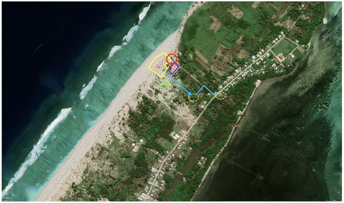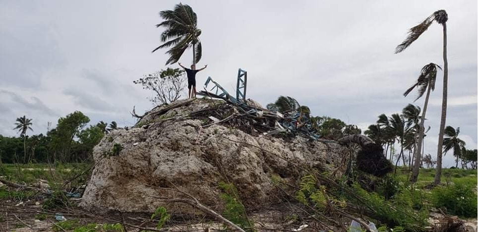
Ha’atafu was the scene of remarkable tales of survival. Moana Paea, proprietor of the Ha’atafu Beach Resort described hearing a commotion from the beach area as the first surges rose above the high tide level, reaching the beachside boundary of the resort. At the same time, Australian High Commissioner Rachael Moore, who was at the resort with her family, observed and photographed these early surges indicating a time of ~0415 UTC (17:15 local) for the first significant waves. Videos shared on social media also show local residents who had been spending the day on the beach, returning to their cars after being chased off the beach by the first surges. Ms. Paea and her staff began alerting other guests to leave the resort, all of whom went to the carpark and began to leave by vehicle. A second video obtained from social media shows the vehicles evacuating as a tsunami surge rushes up the road adjacent to the resort, toppling a fence as it progresses inland and narrowly missing a car full of people that had been parked on the waterfront. As this was going on Ms. Paea, her family and staff, noting the vehicular congestion, fled on foot in search of a large ‘tsunami rock’ they had previously identified as high ground for potential tsunami evacuation. While looking for this rock in the heavily vegetated bush area behind the resort, they felt and heard one of the large explosions and shock waves released during the eruption, noting that ‘it felt like a bomb’ and nearly ‘knocked [us to the] ground’. Unable to locate the ‘tsunami rock’ the group continued by foot to the lagoon side of the peninsula seeking refuge with others on the roof of a house. Their inability to locate the tsunami rock was fortuitous in that the tsunami surges completely overtopped the rock leaving it covered with debris.
More discussion about this remarkable escape can be found in the open-access paper “Tsunami Runup and Inundation in Tonga from the January 2022 Eruption of Hunga Volcano” published in Pure and Applied Geophysics.